
Draw property boundaries on satellite maps to measure acreage, separate turf from tree canopy, and generate reliable labor-hour estimates—without an initial site visit.

“We used to send estimators to properties just to collect basic measurements. With Garden, we draw the boundaries remotely and generate accurate quotes in seconds.”
— VP of Operations, Commercial Landscaping Group
Traditional landscaping estimates often depend on site visits, ground-level photos, and manual measurements. These methods can make it difficult to distinguish low-maintenance turf from dense tree canopy, especially when much of the property is hidden from street level. A proposal based on incomplete visual information can easily underestimate the required labor and reduce profit margins. Overestimating the work creates the opposite problem: the bid becomes less competitive and may lose the project.

“We sometimes underbid a job based on what we could see from the curb, only to discover on site that a large portion of the property was dense tree canopy requiring significantly more labor.”
— Senior Estimator, Commercial Grounds Management
Garden replaces manual estimation with remote geospatial analysis. Users can outline a single property or map multiple locations for a larger commercial tender using high-resolution aerial imagery. The platform calculates the total site area, identifies vegetation, and separates open grass from tree coverage. Teams can then apply their own productivity rates to the spatial measurements and generate realistic labor-hour projections before submitting a proposal. This gives estimators a more consistent, data-backed basis for pricing.
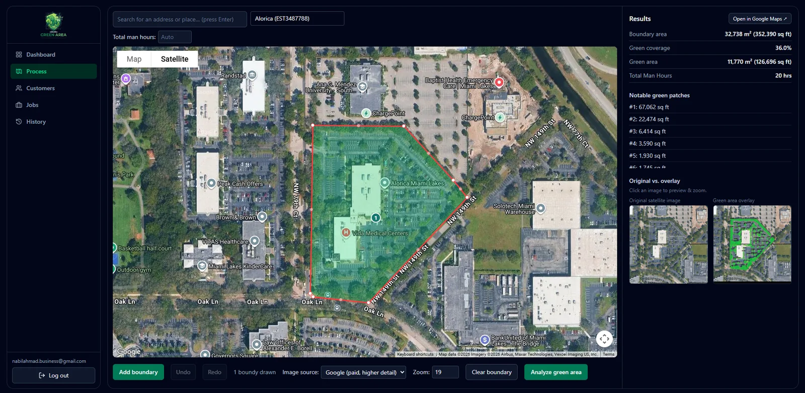
“Garden gives us the confidence to quote from satellite takeoffs. The turf and canopy breakdown is detailed enough to support both our pricing and our crew schedules.”
— VP of Operations, Commercial Landscaping Group
Garden helps landscaping companies reduce unnecessary site visits while improving the accuracy of their labor estimates. By identifying tree canopy—the factor that can have a major impact on maintenance time—teams can create budgets that more closely reflect actual field conditions. The platform also supports batch analysis, allowing enterprise sales teams to evaluate multiple properties or entire commercial developments at once. This increases estimating capacity during busy bidding periods without requiring a matching increase in travel or field work.
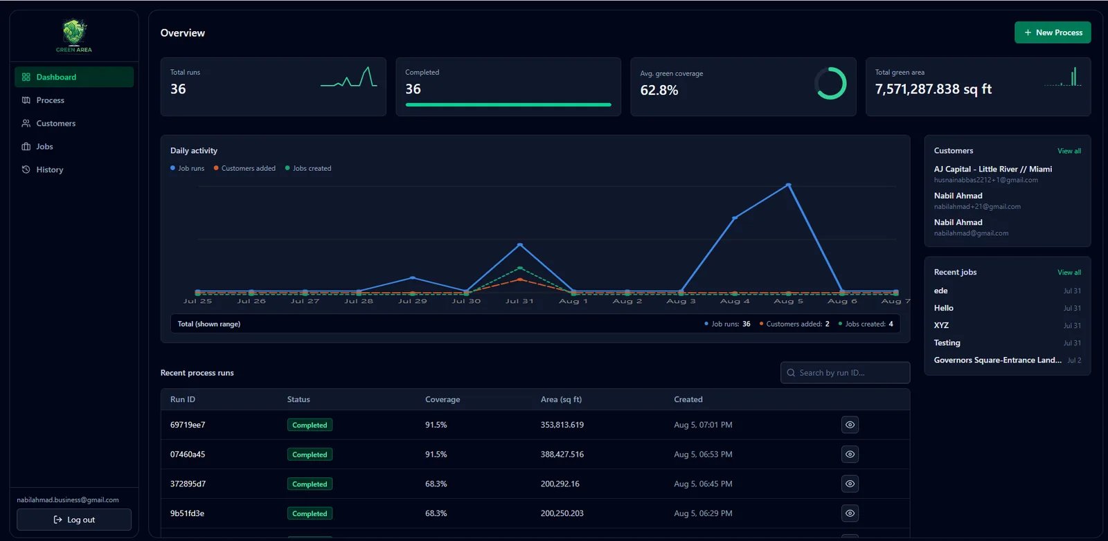
“Even a small error in the canopy estimate can affect the profitability of a maintenance contract. Garden helps ensure our labor assumptions are based on the actual property, not a curb-side guess.”
— Regional Operations Director, Field Services
Expanding estimating capacity no longer requires sending teams to every property first. Reliable geospatial data allows operators to assess more opportunities remotely and prepare bids with greater confidence.
Landscaping crews already knew how to complete the work. The challenge was obtaining accurate measurements and understanding the site conditions before submitting a proposal.
Garden gives commercial landscaping companies a faster way to perform property takeoffs remotely. By combining aerial imagery, turf and canopy segmentation, and customizable labor models, the platform helps ensure that every bid is supported by measurable site data.
“We no longer have to add unnecessary padding to every proposal to protect ourselves from unknowns. We have clearer site data, so we can bid competitively while protecting our margins.”
— VP of Operations, Commercial Landscaping Group